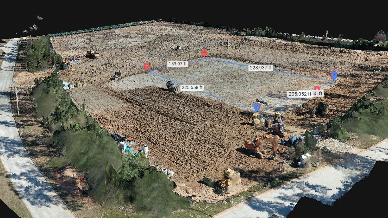
From property identification thru all phases of construction, providing stakeholders real-time project progress and survey-grade field data. Using Ground Control Points (GCP) we can accurately provide a variety of property measurements and volumetric dimensions. Our Orthomosaic and corresponding Digital Surface Model (DSM) can offer a 3D view of the construction site.

Aerial Site Intelligence
Improve communication, save time and costs by using drone data to perform surveys, conduct inspections, and document every phase of a job site. Using our cloud-based software to communicate to the entire project team and owners, customers gain insights through frequent aerial imagery, interactive digital maps and in-depth analysis all with centimeter-level accuracy. Thus, projects run on time, on budget, and safely.
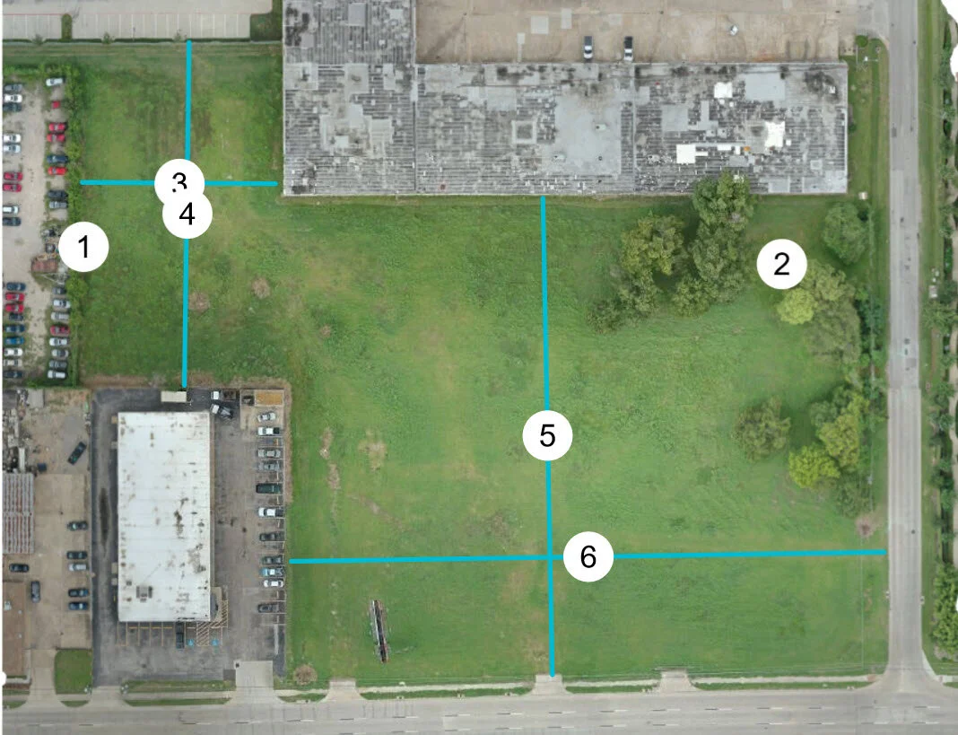
Web based access to construction projects aerial imagery and site data facilitate easy communication with all stakeholders to monitor progress and more. From property identification through infrastructure development through all phases of construction, project managers are finding drone mapping to be an indispensable tool. SkyDrone Services uses imaging-informatics software to create high-resolution orthomosaic, elevation and 3D models in a matter of hours. Combined with centimeter-level precision we offer built-in measurement tools and annotations, as well as 4k video overview. We provide real-time tabs on projects and identify potential issues before they become costly. Our cloud-based imaging data makes for a cost-effective easy to access tool companies can capitalize on immediately and see a solid return on investment.